Samhain Waning Wolf Moon
Find the mittens and the mad bomber hats. Haul the toboggan out of the rafters, wax up those cross-country skis and check the bindings on your snowshoes.
Oh, yeah. You might want gas for the snowblower. Dig out the snow shovels from that place you put them last March. Where was that again?
I don’t know about you but I’m hoping for the big hit. A good snow fall will amp up the seasonal cheer.
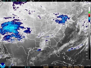
According to NOAA and Paul Douglas, this is the real deal, heading in with heavier than normal moisture, winds and a track that seems to keep lifting north from the original predictions of a storm that would hit mainly southern Minnesota.
(NOAA GOES graphic showing the storm as it moves east and north)
Excerpt below from NOAA Winter Weather Watch:
MODEL TRENDS OVER THE PAST 12 HOURS HAVE THIS STORM SYSTEM STRONGER AND MAY PRODUCE HIGHER WIND SPEEDS DURING THE HEIGHT OF THE STORM LATE TUESDAY NIGHT…AND INTO WEDNESDAY AFTERNOON.
THE WINTER STORM WATCH EXTENDS FROM REDWOOD FALLS TO MORA ON EASTWARD…INCLUDING THE TWIN CITIES METROPOLITAN AREA AS WELL AS ALL OF WEST CENTRAL WISCONSIN. SNOW AND STRONG NORTHERLY WINDS ARE POSSIBLE FROM LATE TUESDAY AFTERNOON THROUGH WEDNESDAY WITH SNOW TOTALS REACHING OR EXCEEDING SIX INCHES. A WINTER STORM WATCH MEANS THERE IS A POTENTIAL FOR SIGNIFICANT SNOW…SLEET…OR ICE ACCUMULATIONS THAT MAY IMPACT TRAVEL. CONTINUE TO MONITOR THE LATEST FORECASTS.
